|
|
Ventura County
|
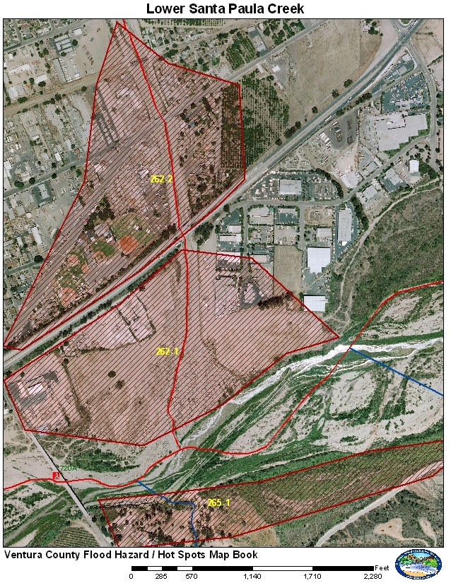
GIS Hot Spot ID:
262-1 Santa Paula Creek below Hwy 126
262-2 Santa Paula Creek Railroad to Hwy 126
265-1 Santa Clara River (South Mountain Properties)
Santa Paula Creek has had a history of flooding issues on the lower end where it confluences with the Santa Clara River. Due to slope changes of the channel and high water surface elevation in the Santa Clara River, sediment settles in the lower end of Santa Paula Creek. If the sediment load is significant enough, Santa Paula Creek will fill its channel and flood parts of Santa Paula. The sediment may also alter the path of the Santa Clara River causing erosion issues for residences along South Mountain Road. A Coprs project to provide protection along Santa Paula Creek wad constructed and tested during the 2005 season. The Corps project has not been turned over to VCWPD.
Historical Data
Santa Paula Creek has had a history of flooding parts of Santa Paula. Breakouts start just above the railroad and flood both the east and west sides of the channel. Historic flows have flooded areas all the way down to the Santa Paula Airport. Each time the issues have been sediment deposition in the lower reach reducing capacity and cuasing high flows to break through levees and flood the city.
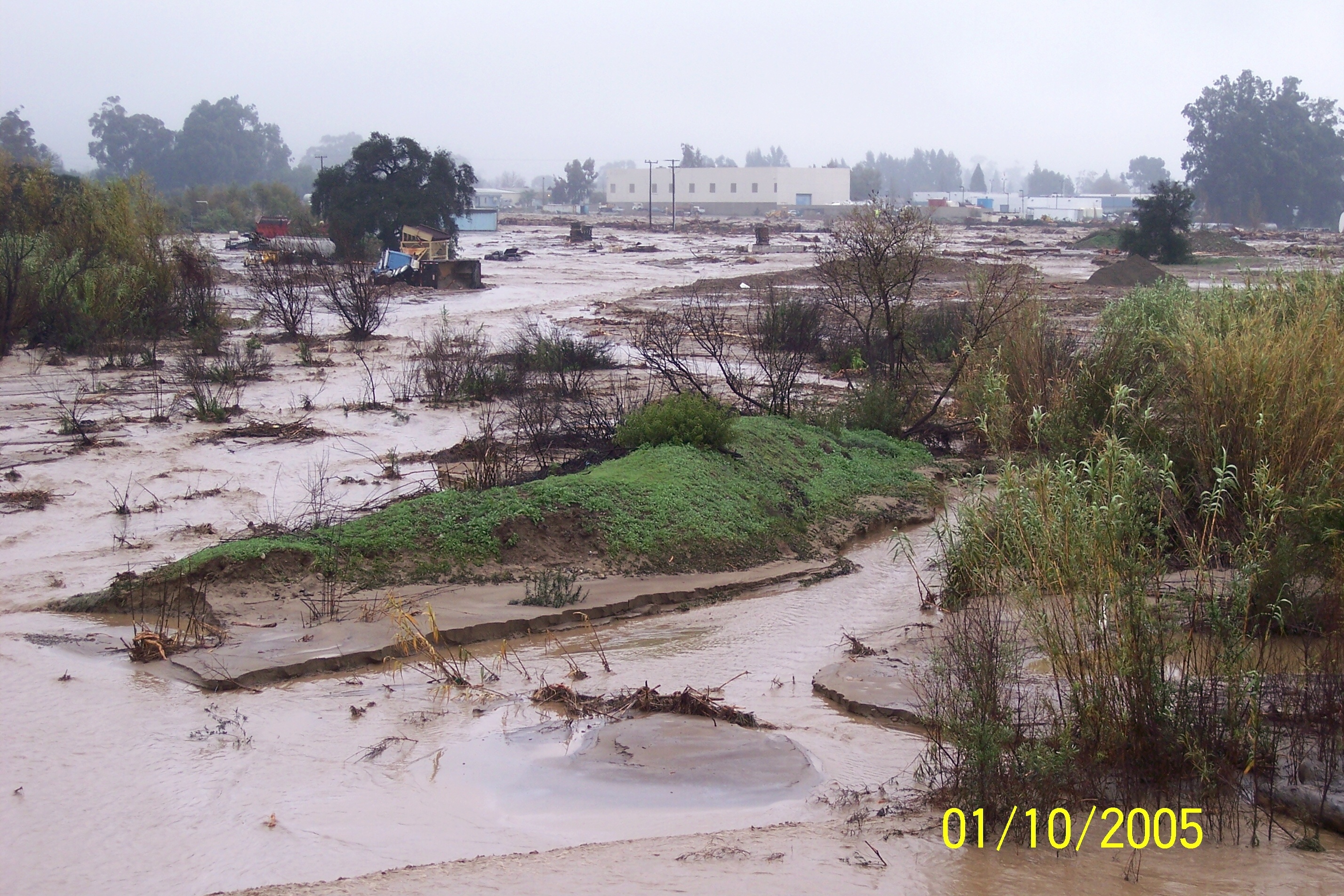
The January 10, 2005 storm produced a peak of 27,500 cfs at the stream gage at Mupu Bridge. This flow caused significant erosion issues upstream including wiping out parts of Highway 150. The end results was the sediment was dumped at the lower end of Santa Paula Creek. Santa Paula Creek did break out of its channel and flooded a construction company on the west side of Santa Paula Creek below Highway 126. Significant erosion was also reported to residences along South Mountain Road along the Santa Clara River. No flooding was reported above Highway 126.
Aerial Photo and Map

Photos of Area

Santa Paula Creek breakout Jan. 10, 2005, NWS
photo.

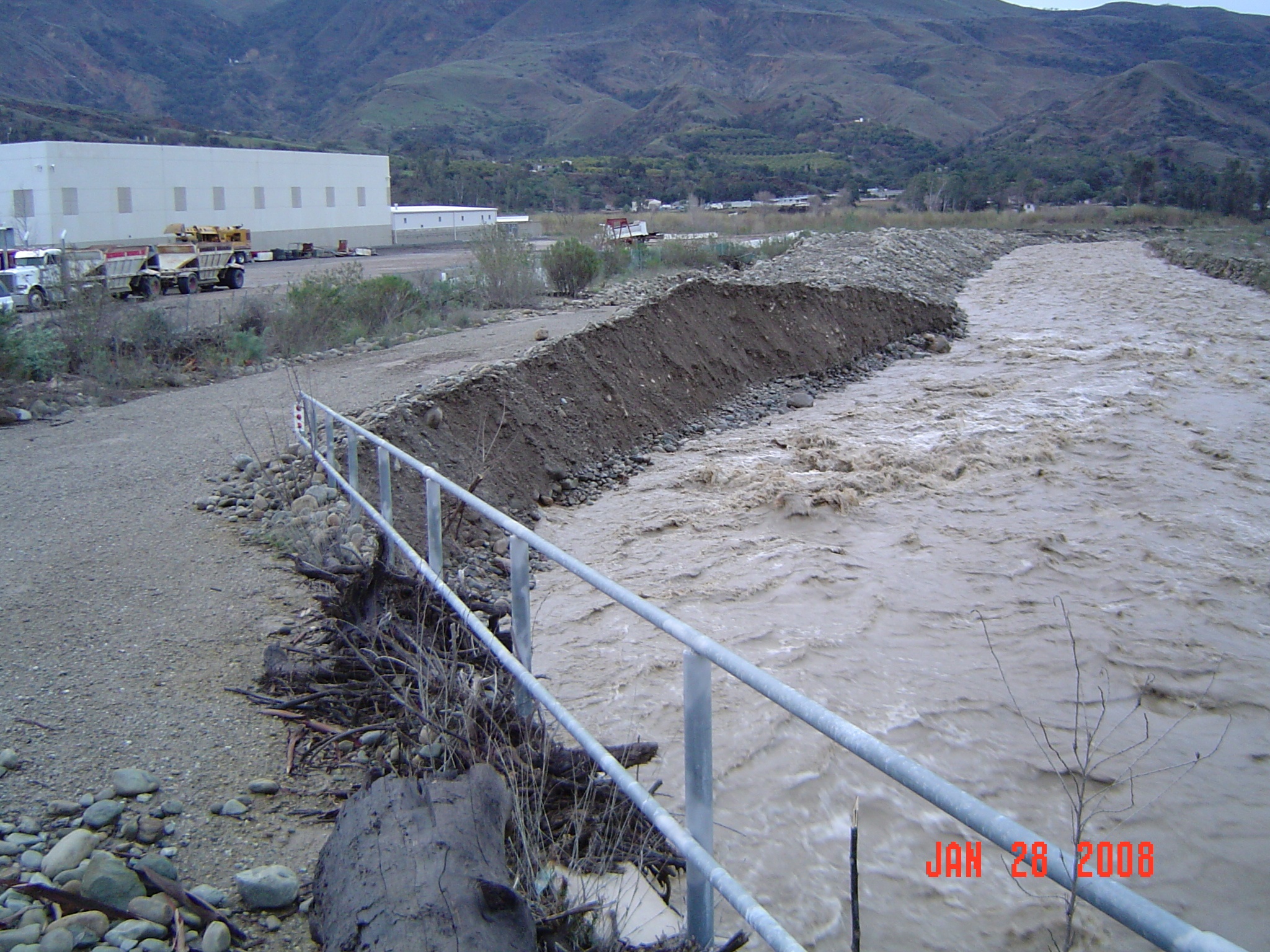
Channel after Corps cleanout and temporary berm
after activation of EAP in Jan. 2008, VCWPD photo

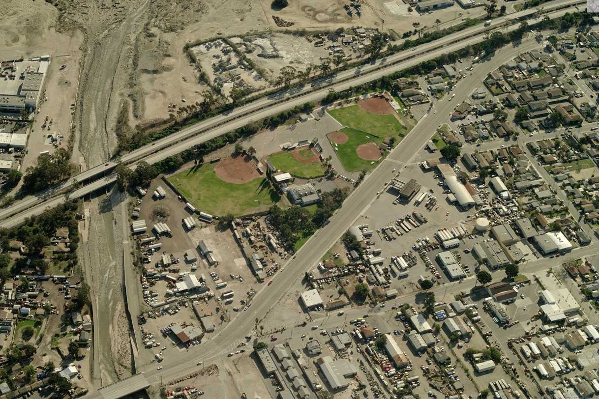
Aerial showing sediment after January 2008
storms, Pictometry photo
Gages
There is only one stream gage site in the Santa Paula Creek Watershed located at Steckel Park on the Mupu Brudge. There are currently 3 measuring equipment at the site. The USGS has a radar and bubbler system transmitting on GOES. VCWPD has a radar unit that transmits on ALERT. These gages provide a good approximation of the flows for the Lower Santa Paula Creek. It takes the peak between 30 minutes to 1 hour for the flow to reach Hwy 126 from the stream gage site.
Special Conditions/ Issues
The storms of 2005 filled the lower Santa Paula Creek channel with sediment. Army Corps of Engineers cleared the channel Fall 2009. Original criteria used after Dec 2009.
Consult the Hydrology Reference to the Santa Paula Creek EAP located:
K:\pr\hydrology\fwsDocs\HotSpots\Supporting Docs\Santa Paula EAP\Santa Paula Creek EAP.doc
Minimal Time for Implementation
Notice for Emergency Cleanout: 3-7 days
Evacuation below Hwy 126: 3 hours? (more if possible)
Evacuation above Hwy 126: 3-6 hours? (more if possible)
Special Conditions Procedure
Condition: Sediment deposition and reduced capacity in Lower Santa Paula Creek since January 2005.
Implemented: 2006; Expected expiration date: Dec 2009
Gages Used: 709
|
Criteria |
Value |
Issue |
Area |
Procedure |
|
Forecasted Rain |
4.3 in |
Activation of EAP use SESC1 (RFC Forecast Model) |
Channel Cleanout |
Activation of Santa Paula Creek EAP. Corps. suppose to bring in equipment to move sediment and add capacity to the channel. Coordinate with Peter Sheydayi. |
|
Flow |
4,000 cfs |
Activation of EAP (Flood Fighting) |
262-1 |
Notification of possible active flood fighting below Highway 126. Monitor patrols needed to watch water levels below Highway 126. Coordinate with O&M, Peter Sheydayi, and OES. |
|
Flow |
4,500 cfs |
Flooding |
262-1 |
Nearing capacity of Lower Santa Paula Creek below Highway 126. Coordinate with O&M, Peter Sheydayi, and OES. |
|
Flow |
8,000 cfs |
Flooding |
262-1 and 262-2 |
Need patrols for Santa Paula Creek between the railroad and Highway 126. Additional sedimentation could cause Santa Paula Creek to flood homes and businesses north of Highway 126. Coordinate with O&M, Peter Sheydayi, and OES. |
|
Flow |
9,000 cfs |
Flooding |
262-1 and 262-2 |
Continue patrols between railroad and Highway 126. May need to start active flood fighting at Highway 126 and consider evacuations near Harvard Blvd. Coordinate with O&M, Peter Sheydayi, and OES. |
|
Flow |
10,000 cfs |
Flooding |
262-1 and 262-2 |
Should be near or at capacity at Highway 126. Active flood fighting or evacuation should be in progress. |
Normal Conditions Procedure
Gages Used: 709
|
Criteria |
Value |
Issue |
Area |
Procedure |
|
Flow |
13,000 cfs |
Sediment / Flooding |
262-1 |
Sediment deposition may be occurring below Highway 126. Patrols are needed to monitor the situation. Coordinate with O&M and OES. |
|
Flow |
16,000 cfs |
Sediment / Flooding |
262-1 |
Sediment deposition likely occurring reducing capacity. Patrols should warn businesses below Highway 126 and continue to monitor situation. |
|
Flow |
20,000 cfs |
Sediment / Flooding |
262-1 |
Possible breakouts below Highway 126 depending on sedimentation issues and backwater from the Santa Clara River. Patrols may need to be extended between Harvard and Highway 126. |
|
Flow |
25,000 cfs |
Sediment / Flooding |
262-1 and 262-2 |
Potential exists for possible breakouts above Highway 126. Patrols needed between railroad and Highway 126. Consider evacuations for residences near Santa Paula Creek and just North of Highway 126. |
|
Flow |
28,000 cfs |
Sediment / Flooding |
262-1 and 262-2 |
High potential for flooding above Highway 126. Active flood fighting, evacuations and patrols are needed east of 12th Street between Harvard Blvd and Highway 126. |
|
Flow |
35,000 cfs |
Flooding |
262-1 and 262-2 |
Widespread flooding eastern Santa Paula from railroad to 10th Street north of Highway 126. |
|
Flow |
45,000 cfs (Sta Clara) |
Erosion |
265-1 |
If sedimentation exists at the confluence with Santa Paula, the flow of the Santa Clara River may be focused on the residences along South Mountain Road. Patrols (Sheriff) may be needed to monitor rate of erosion and see if any residences may need evacuation. |
|
Flow |
100,000 cfs (Sta Clara) |
Erosion |
265-1 |
Erosion may be occurring along the Santa Clara River. Patrols (Sheriff or Fire) may be needed to monitor rate of erosion and see if any residences along South Mountain Road need evacuation. |
Data Source
Thresholds are set to engineering judgment because the sediment issue cannot be easily measured. Thresholds are set to lower values due to unknown sedimentation issues. Actual flooding may occur at higher values. EAP conditions were set with coordination between VCWPD and the Corps. Numbers above Highway 126 were adjusted after work and erosion of sediment from the January 2008 storms.
Hydrology Implementation of EAP:
K:\pr\hydrology\fwsDocs\HotSpots\Supporting Docs\Santa Paula EAP\Santa Paula Creek EAP.doc